As Indigenous elders age, the original placenames used to navigate the land we live on in Canada run the risk of being lost to time.
To ensure this important information is remembered, recorded and shared within Indigenous communities and beyond, Carleton University researcher and alumna Rebekah Ingram created the Atlas of Kanyen’kehà:ka (Mohawk) Space in collaboration with Kahente Horn-Miller, associate professor in Carleton’s Institute of Interdisciplinary Studies.
The project uses digital technology, drones and other tools to create a map where areas are labeled with Kanyen’kehà:ka placenames, all in an effort to revitalize the language itself and enrich the way we experience and understand these spaces.
Alongside Akwesasne-based community researcher Ryan Ransom, Ingram and Horn-Miller are working in close collaboration with Kanyen’kehà:ka communities. They are speaking with elders and holding summer camps in Akwesasne where local youth can explore the land and add photos, videos, notes and stories to help build out the atlas.
“The kids have so much fun, and so do we,” says Ingram, who received messages from parents after last year’s camp sharing that their children were now proudly able to do things like identify plants using Kanyen’kehà:ka words.
“We get to watch language learning happen in real time.”
Learning Language Through the Landscape
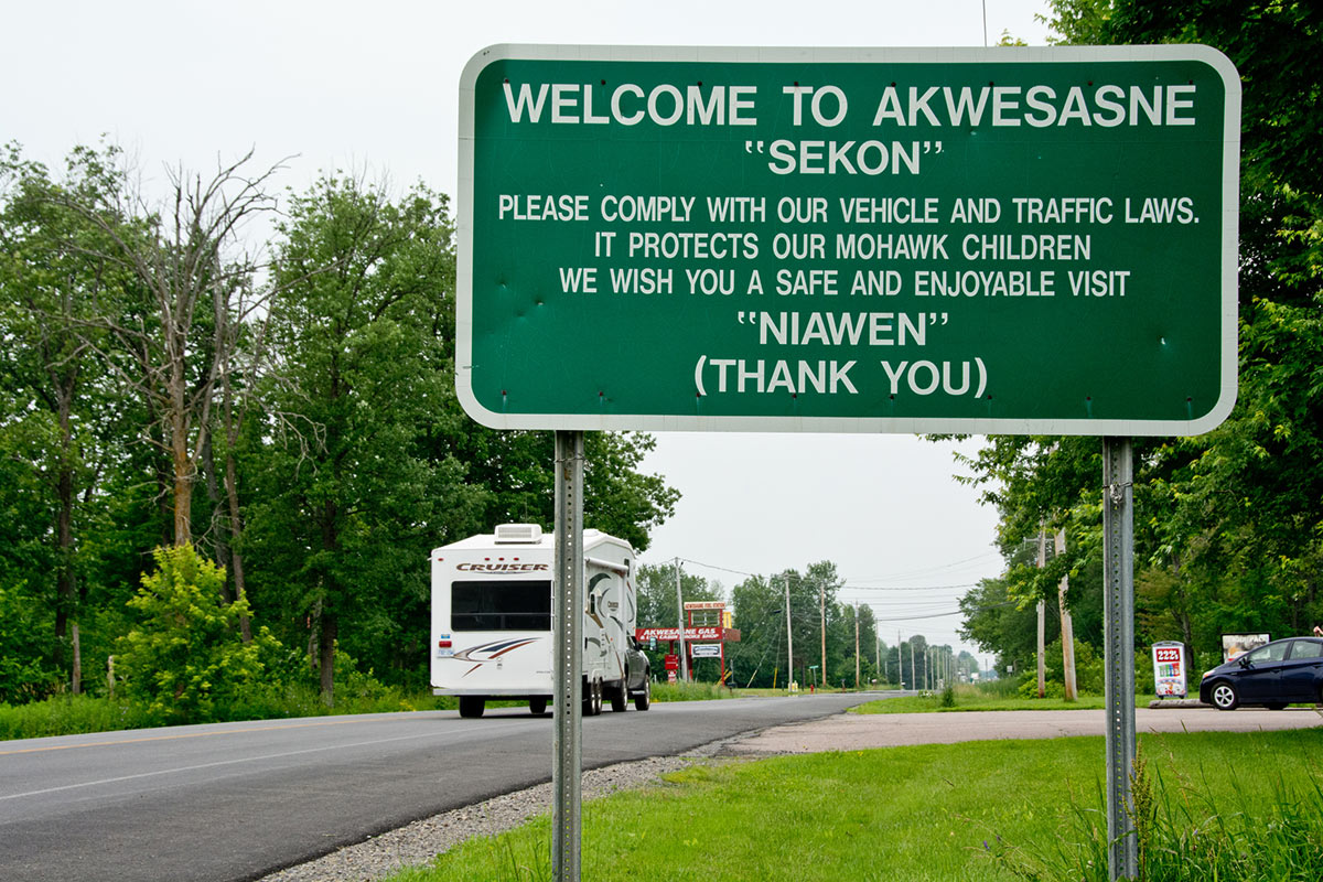
This summer will mark the project’s third youth camp in Akwesasne – a Mohawk Nation territory located at the intersection of multiple international and provincial borders whose very existence demonstrates how most maps fail to accurately reflect – and, more often than not, intentionally divide apart – Indigenous territories.
The idea for the summer camps came from Ryan Ransom, a STEM educator who works with Akwesasne high school students. Ransom says he’s made a habit of collecting and researching Kanyen’kehà:ka words for much of his life.
“It’s a different way of approaching language revitalization in our community,” says Ransom.
“We can use placenames and this project to teach about history, our connection to the land and the surrounding environment.”
At last year’s summer camp, researchers, campers and community members used aerial and underwater drones to view the land from different vantage points. This is crucial because Indigenous placenames are contextual to the land itself – a river will be named “Little Fish River” for instance, to indicate that the water is shallow and therefore only contains certain smaller species of fish.
As a result, Indigenous placenames contain information and clues that help us understand how a place was historically and culturally used, what the land itself used to look like, and track environmental changes in flora, fauna and topography over generations.
“Each name is this huge bundle of knowledge that’s at risk of being lost due to language endangerment,” explains Ingram.
“It’s like a ball of yarn and you don’t know what it’s attached to until you follow the trail through historical research, talking to people and going out on the land yourself.”
Importance of Indigenous Data Sovereignty
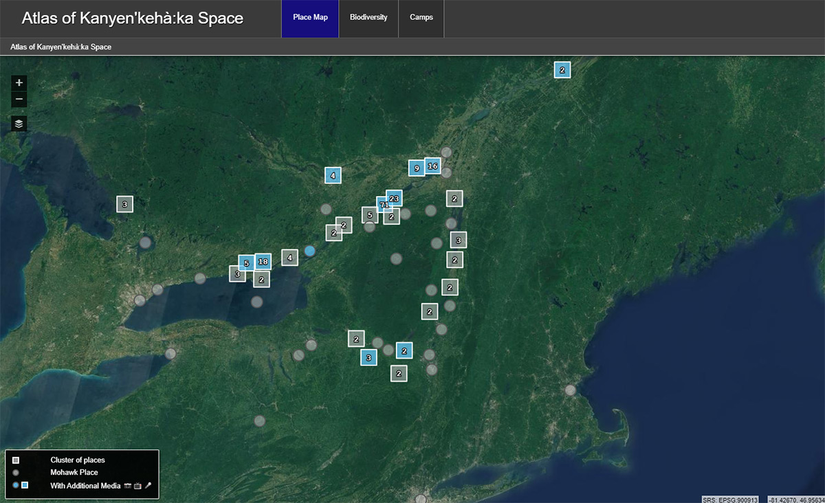
The atlas itself – which currently contains 198 pins and 188 media files and counting – grew from Ingram’s doctoral work in the School of Linguistics and Language Studies at Carleton.
“Linguistics should be supporting language revitalization work, and traditionally we have not been very good at that,” she explains. “The words on the pages of my thesis just weren’t doing the language and these placenames justice.”
This led to her connecting with Kahente Horn-Miller, an expert in Haudenosaunee-specific research and pedagogical practices and a researcher in Carleton’s Institute of Interdisciplinary Studies.
“Borders and the reserve system created lines and barriers for Indigenous people,” says Horn-Miller.
“Through this project, as an Indigenous person, you start to see things in a different way, and you begin to better understand our relationship with the land.”
The project also taps into the crucial topic of Indigenous data sovereignty – the right of Indigenous peoples to access, control and own the knowledge generated about their communities and histories.
To ensure data sovereignty, rather than relying on popularly used platforms like Google or Apple Maps, the base map layer featured in the atlas was built from scratch using spliced satellite imagery and the atlas itself is hosted through Carleton’s Geomatics and Cartographic Research Centre.
“Many people don’t know this, but when you input anything into Google or Apple Maps, you can lose ownership of that data,” Horn-Miller explains. “It’s incredibly problematic, because this knowledge inherently belongs to the Kanyen’kehà:ka people.”
With another summer in Akwesasne already on for 2024, the researchers hope to one day bring the youth summer camp model to Horn-Miller’s community of Kahnawake. They also plan to host more workshops with Indigenous elders to continuing sharing and discussing placenames.
“The really incredible aspect of this whole project is that we’re developing a methodology for revitalizing languages that really works and can be applied anywhere in Canada or around the world,” says Horn-Miller.
“It’s all about reinvigorating and preserving our understanding of the places where we live and engage with.”